Custom Data Loading of GeoGraphix Projects Using SAS™ - GOM example
![]()
Contents:
| Project Summary | |
| Key Features |
![]()
Project Summary
The Minerals Management Service (MMS) of the has placed on their website, data on all of the offshore well information. This information is available to the public in MMS format. This work was done for a client who needed this data place in their corporate database as a GeoGraphix project. Since their efforts required a Gulf of Mexico project of all data, the main feature of this work is a single project with all the MMS data rather than just a subset.
Figure - Gulf of Mexico index map of MMS data coverage. Not show is detail from the
Eastern GOM.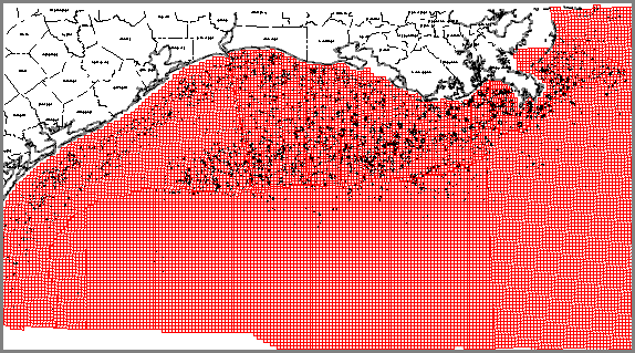
![]()
Key Features
Well deviation surveys from the MMS are given in grid-north format. The GeoGraphix
system uses deviation surveys in true-north format. All deviation surveys in from the MMS
were converted to true-north format with the grid-north format included as a backup should
they be needed.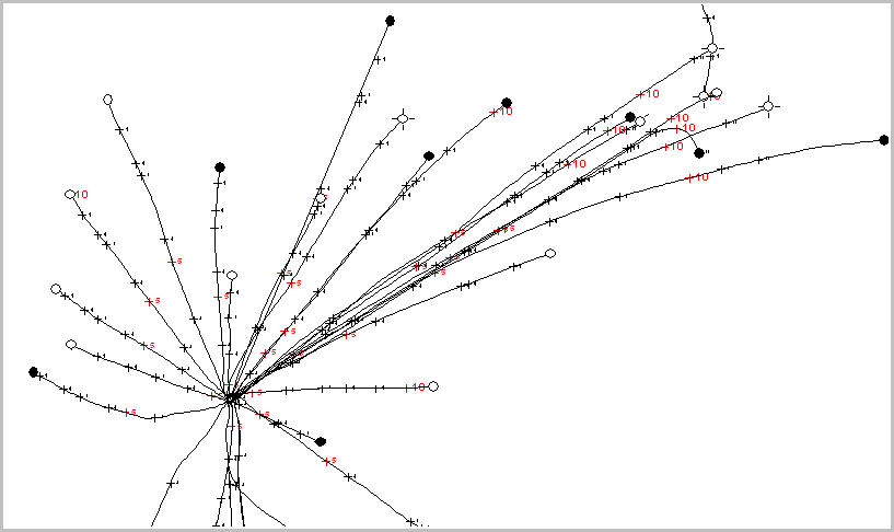 | |
| Detailed bathemetry was created from MMS well data and block data. Water depth is a very important economic element in off-shore Gulf of Mexico operations. | |
| Pipeline cultural data was includeded with the dataset. The data was broken-down into
oil, gas, service, and abondoned pipeline segments with pipeline diameters included as a
visual element. This is an example map. 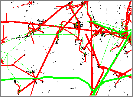 | |
| Shipping lanes were outlined as a cultural file showing areas where surface activities are regulated. | |
| Offshore block designations were added. |
![]()